After headaches importing elevation (DEM) data into Forsk Atoll, I found a better mechanism for converting them,
I’d been having issues with as soon as the elevation passed 255 meters, resetting to 0 in the PNG as it didn’t understand values beyond this.
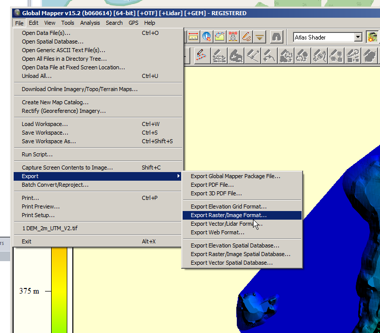
I was able to open the elevation data in GlobalMapper (You can use the trial if required), then selecting Export -> Export Raster/Image Format,
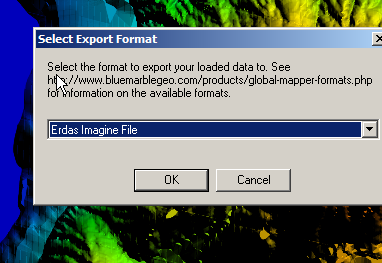
Then select Erdas Image File
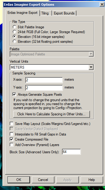
Set file type to Elevation 16-bit integer samples,
Now you should be able to import it straight into Atoll as your elevation data.