Tag Archives: Atoll

Forsk Atoll – Importing Antennas

I recently had a bunch of antennas profiles in .msi format, which is the Planet format for storing antenna radiation patterns, but I’m working in Forsk Atoll, so I needed to convert them,

To load these into Atoll, you need to create a .txt file with each of the MSI files in each of the directories, I could do this by hand, but instead I put together a simple Python script you point at the folder full of your MSI files, and it creates the index .txt file containing a list of files, with the directory name.txt, just replace path with the path to your folder full of MSI files,

#Atoll Index Generator
import os
path = "C:\Users\Nick\Desktop\Antennas\ODV-065R15E-G"
antenna_folder = path.split('\\')[-1]
f = open(path + '\\' + 'index_' + str(antenna_folder) + '.txt', 'w+')
files = os.listdir(path)
for individual_file in files:
    if individual_file[-4:] == ".msi":
        print(individual_file)
        f.write(individual_file + "\n")

f.close()

Which you can then import into Atoll, easy!

Converting Elevation Data (DEM) for Forsk Atoll

After headaches importing elevation (DEM) data into Forsk Atoll, I found a better mechanism for converting them,

I’d been having issues with as soon as the elevation passed 255 meters, resetting to 0 in the PNG as it didn’t understand values beyond this.

I was able to open the elevation data in GlobalMapper (You can use the trial if required), then selecting Export -> Export Raster/Image Format,

Then select Erdas Image File

Set file type to Elevation 16-bit integer samples,

Now you should be able to import it straight into Atoll as your elevation data.

Making use of Australian Elevation Data in Forsk Atoll

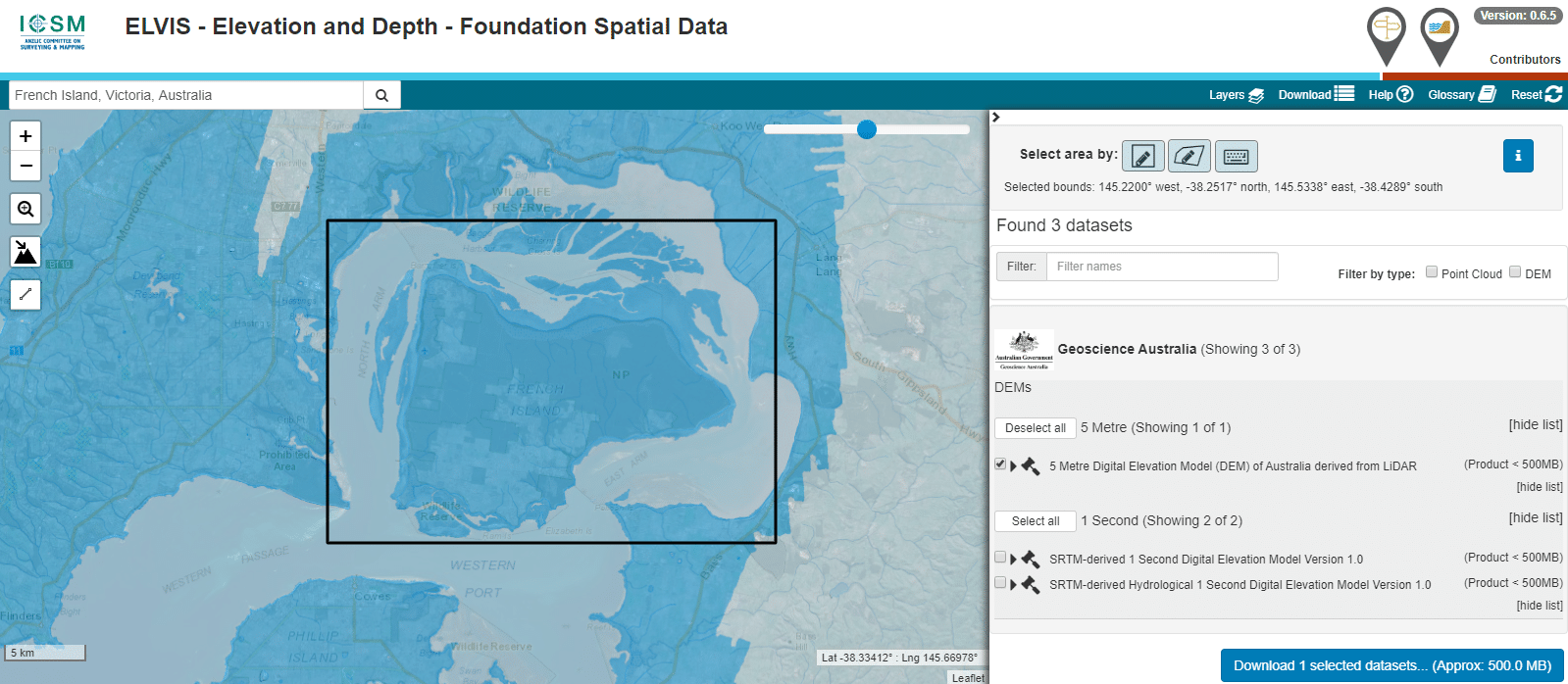
The Australian Government publishes elevation data online that’s freely available for anyone to use. There’s a catch – If you’re using Forsk Atoll, it won’t import without a fair bit of monkeying around with the data…

The data is published on a a system called ELVIS – Elevation – Foundation Spatial Data.

You draw around the area you want to download, enter your email address and you’re linked to a download of the dataset you’ve selected.

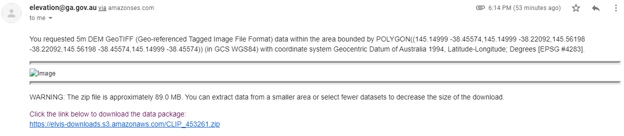
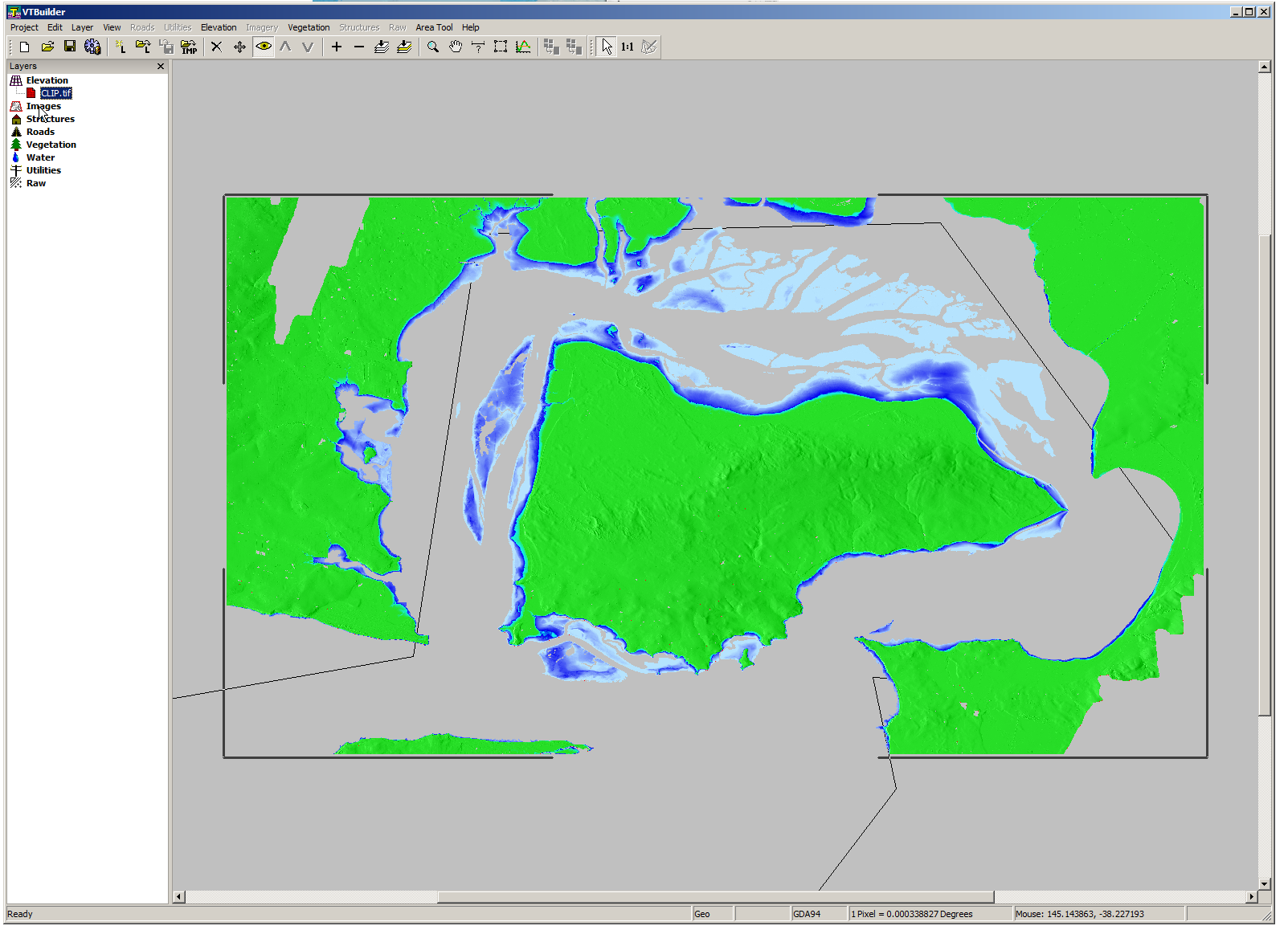
So now we download the data from the link, unzip it and we’re provided with a .tiff image with the elevation data in the pixel colour and geocoded with the positional information.

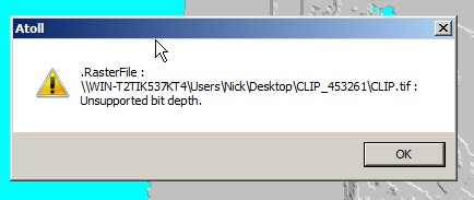
Problem is, this won’t import into Atoll – Unsupported depth.

Forsk Atoll - Unsupported Depth when importing

I found a tool called VTBuilder – A tool for messing with terrain data.

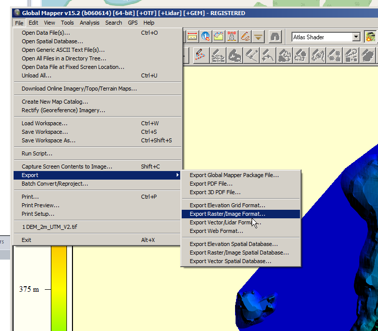
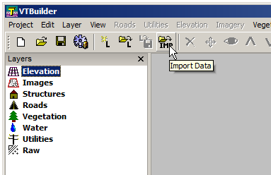
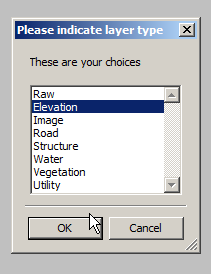
I fired it up, and imported the elevation tiff file we’d downloaded.

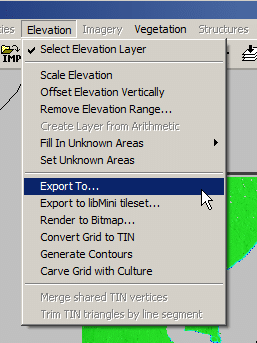
Selected “Elevation” waited a few seconds and presto!

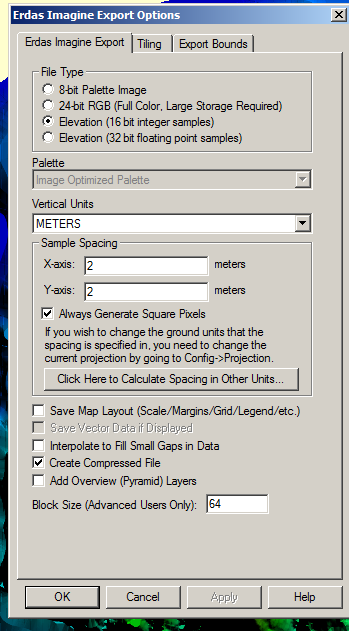
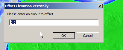
We can export from here in the PNG 16 bit grayscale format Atoll takes, but there’s a catch, negative elevation values and blank data will show up as giant spikes which will totally mess with your propagation modeling.

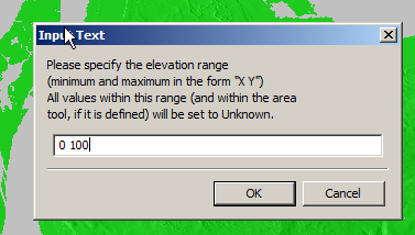
So I found an option to remove elevation data from a set range, but it won’t deal with negative values…

So I found another option in the elevation menu to offset elevation vertically, I added 100 ft (It’s all in ft for some reason) to everything which meant my elevation data that was previously negative was now just under 100.

So if an area was -1ft before it was now 99ft.

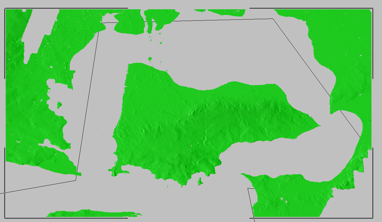
Now I was able to use the remove range for anything from 0 100 ft (previously sea level)

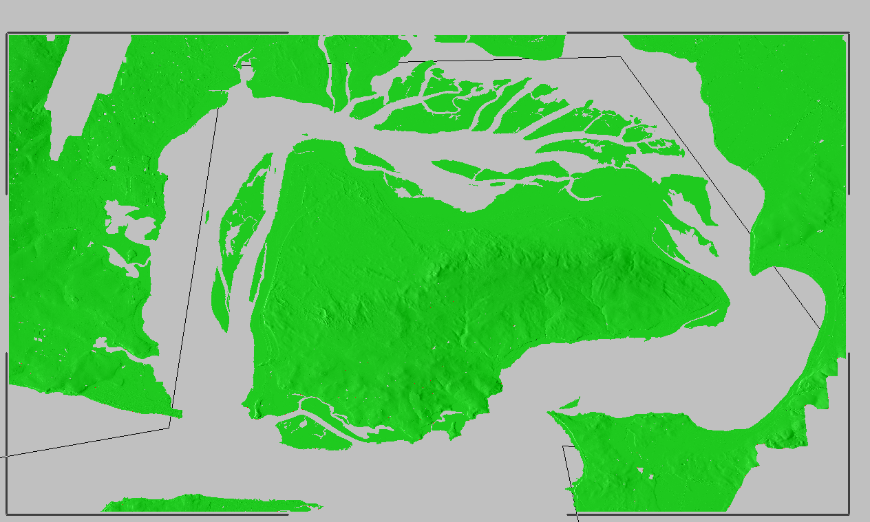
Now my map only shows data above sea level

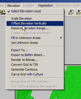
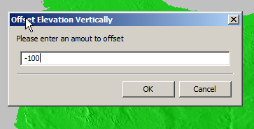
Now I offset the elevation vertically again and remove 100ft so we get back to real values

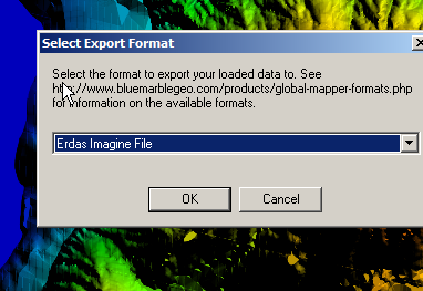
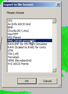
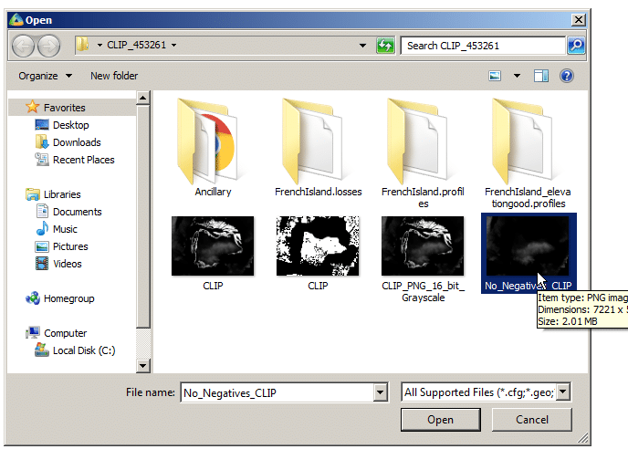
Now I was able to export the elevation data from the Elevation -> Export to menu

Atoll seems to like PNG 16 bit greyscale so that’s what we’ll feed it.

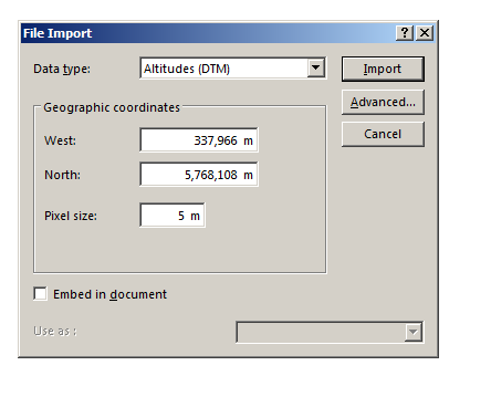
In Atoll we’ll select File -> Import and open the PNG we just generated.

Data type will be Altitude, Pixel size is 5m (as denoted in email / dataset metadata).

Next question is offset, which took me a while to work out…

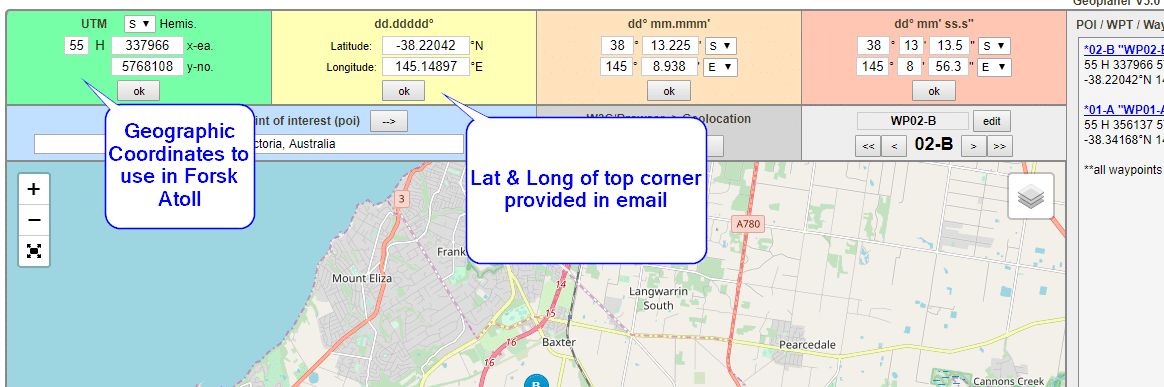
The email has the Lat & Long but Atoll deals in WGS co-ordinates,

Luckily the GeoPlanner website allows you to enter the lat & long of the top corner and get the equivalent West and North values for the UTM dataum.

Enter these values as your coordinates and you’re sorted.

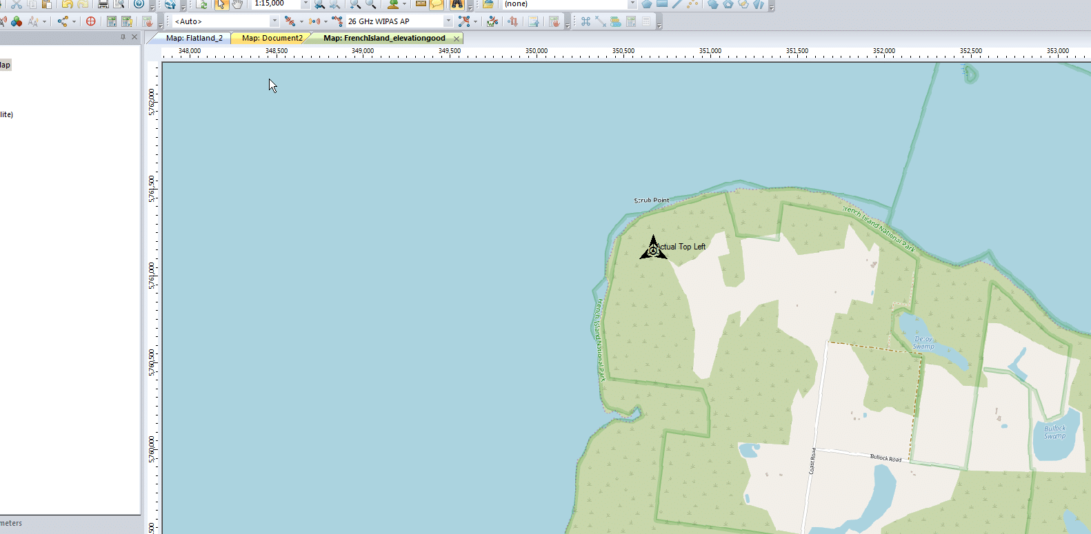
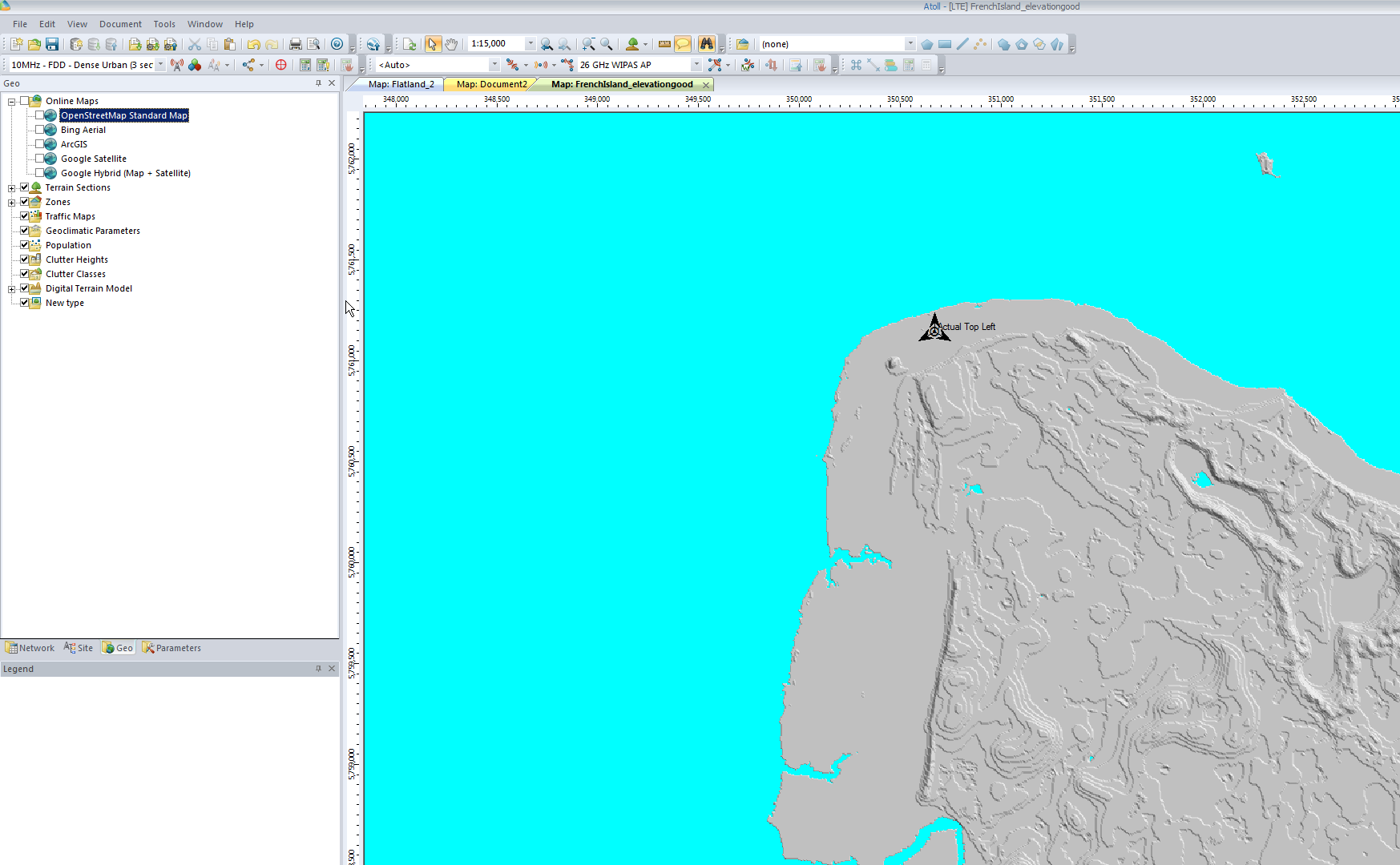
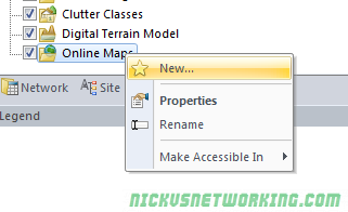
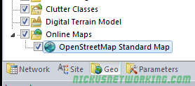
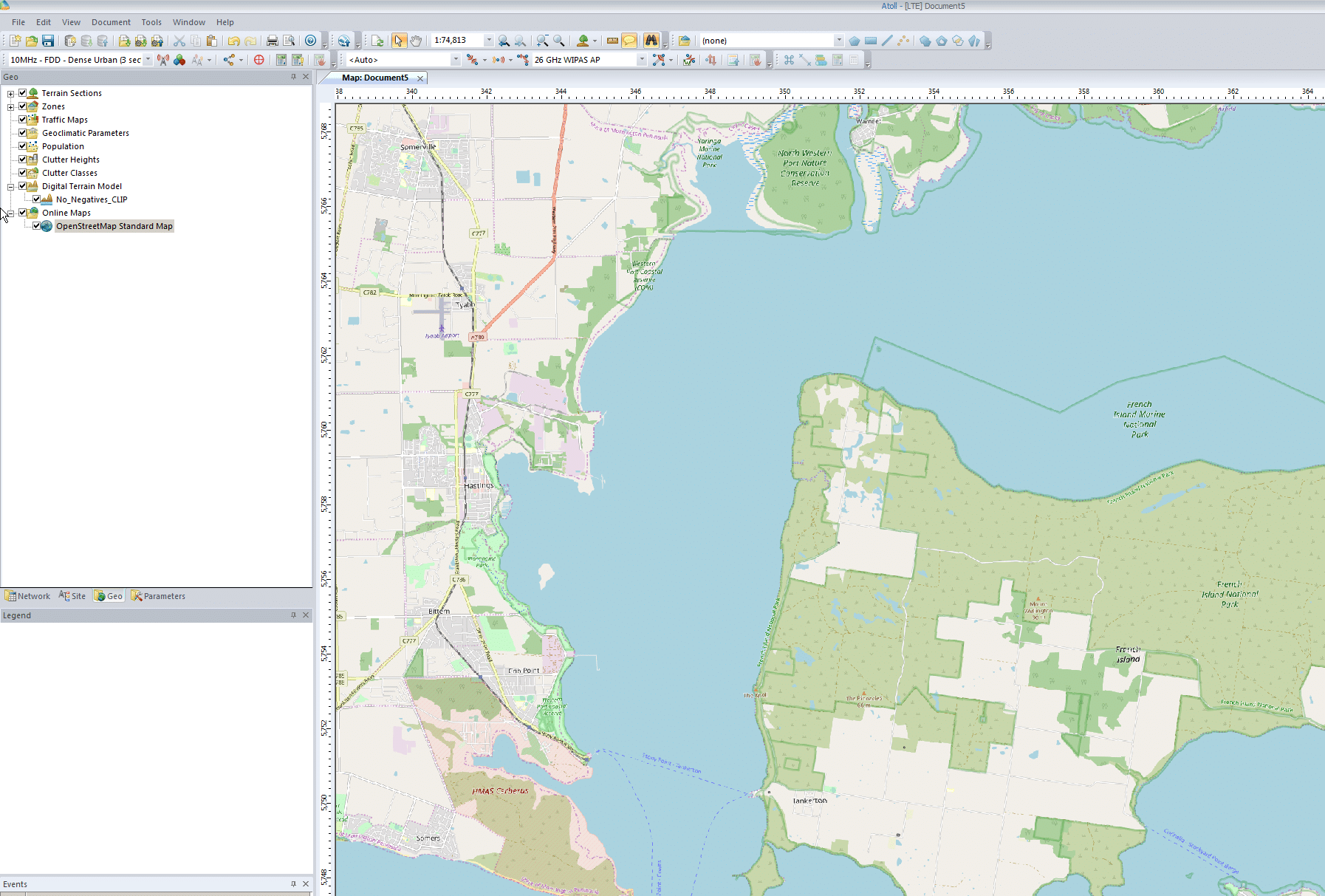
I can even able a Map layer and confirm it lines up:

RF Planning with Forsk Atoll - Importing environmental data

Forsk Atoll – WMS Map Tiles

A hack I found useful to add Google Maps / Google Satelite View / Bing Maps / Bing Arial / Open Street Maps in Forsk Atoll.

Close Atoll,

Go to C -> Program Files -> Atoll

Edit the file named atoll.ini

Paste the following into it:

[OnlineMaps]
Name1 = OpenStreetMap Standard Map
URL1 = http://a.tile.openstreetmap.org/%z/%x/%y.png
Name2 = MapQuest Open Aerial
URL2 = http://otile1.mqcdn.com/tiles/1.0.0/sat/%z/%x/%y.jpg
Name3 = 2Gis
URL3 = http://static.maps.api.2gis.ru/1.0?c...z&size=256,256
Name4 = 2Gis without logo
URL4 = http://tile2.maps.2gis.com/tiles?x=%x&y=%y&z=%z&v=37 
Name5 = Bing Aerial
URL5 = http://ecn.t3.tiles.virtualearth.net.../a%q.jpg?g=392
Name6 = Bing Hybrid
URL6 = http://ecn.t3.tiles.virtualearth.net.../h%q.jpg?g=392
Name7 = Bing Road
URL7 = http://ecn.t3.tiles.virtualearth.net.../r%q.jpg?g=392
Name8 = Yandex Road
URL8 = http://static-maps.yandex.ru/1.x/?ll...=%z&l=map&key=
Name9 = Yandex Aerial
URL9 = http://static-maps.yandex.ru/1.x/?ll...=%z&l=sat&key=
Name10 = Yandex Hybrid
URL10 = http://static-maps.yandex.ru/1.x/?ll...l=sat,skl&key=
Name11 = ArcGIS
URL11 = http://services.arcgisonline.com/Arc...e/%z/%y/%x.png
Name12 = opencyclemap
URL12 = http://tile.opencyclemap.org/cycle/%z/%x/%y.png
Name13 = Google Terrain
URL13 = http://mt.google.com/vt/lyrs=t&hl=en&x=%x&y=%y&z=%z
Name14 = Google Map
URL14 = http://mt.google.com/vt/lyrs=m&hl=en&x=%x&y=%y&z=%z
Name15 = Google Hybrid (Map + Terrain)
URL15 = http://mt.google.com/vt/lyrs=p&hl=en&x=%x&y=%y&z=%z
Name16 = Google Hybrid (Map + Satellite)
URL16 = http://mt.google.com/vt/lyrs=y&hl=en&x=%x&y=%y&z=%z
Name17 = Google Satellite
URL17 = http://mt.google.com/vt/lyrs=m&hl=en&x=%x&y=%y&z=%z
Name18 = Google Scheme
URL18 = http://mt.google.com/vt/lyrs=h&hl=en&x=%x&y=%y&z=%z
Name19 = Google Scheme2 
URL19 = http://mt.google.com/vt/lyrs=r&hl=en&x=%x&y=%y&z=%z

Save and open Atoll,

Open the Geo Tab,

Right click on Online Maps, click “New”

Select the map source (In this example I’m using OSM) & hit Ok.

Enable the Online Map layer by ticking the layer.

Bam, done.

RF Planning with Forsk Atoll - Laying out environmental data